
Old World Auction
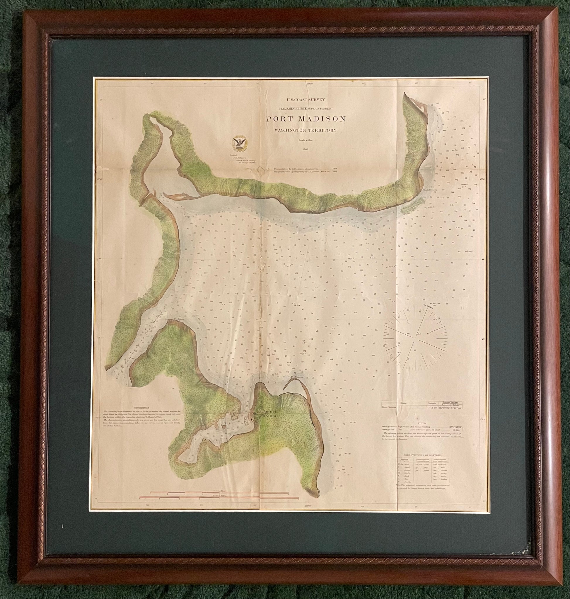
"Port Madison" by U.S. Coast Survey Office
"Port Madison" by U.S. Coast Survey Office
Couldn't load pickup availability
Source: Washington: U. S. Coast Survey Office, 1851.
Color: Colored lithograph.
Date: 1868
Creator: U.S. Coast Survey Office
Size: 18 x 19.5 inches (print within frame); 25 x 27 inches (framed)
Description: This is a nice 1868 U.S. Coast Survey nautical chart or sea chart of Port Madison in the Washington Territory. Depicts Port Madison including surrounding regions of Indianola, Suquamish, Agate Point, in the Puget Sound region. the map offers detailed nautical information essential for navigation, including tide data, soundings, and sailing directions. The map features text, tables, relief shown by hachures, and depths indicated by soundings and shading.
The U.S. Coast and Geodetic Survey was first established in 1807 and is the oldest scientific organization in the U.S Government. After the Civil War, the bureau took responsibility for mapping and conducting geodetic surveys of the the interior of the expanding country. Over the course of the 19th century, the survey worked closely with the U.S. Navy to produce sea charts of the country's coasts, harbors, and waters that could serve scientific as well as military functions. The first superintendent, Ferdinand Hassler, set the foundation for the Survey's rigorous scientific standards, employing advanced techniques and a labor-intensive triangulation system to ensure accuracy. His successor, Alexander Dallas Bache, expanded the Survey's influence, securing funding and overseeing its most critical work from 1843 to 1865. The organization evolved into the U.S. Coast and Geodetic Survey in 1878 and is now part of NOAA as the National Geodetic Survey.
Condition:A
Share
